Netherton House,
West Netherton Street,
Kilmarnock, Ayrshire,
KA1 4BU
Case Study - Roman Settlement at Corbridge, Northumberland

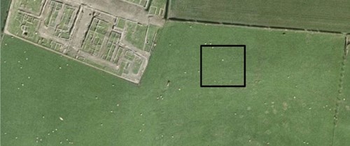
L&M Survey Services were invited to undertake archaeological GPR surveys in land around the existing Corbridge Roman Town, Northumberland. The brief was to cover as much land as possible within a given time scale and budget. The survey of pastureland over what was previously the Roman settlement to see if any further buried ruins could be located.
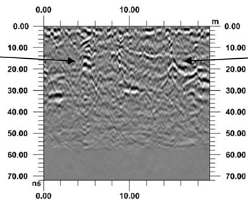
Throughout the survey we used one radar system, a MIRA (Mala Imaging Radar Array) GPR that is tractor mounted and enables a 3D visualisation of the processed data. There were large areas to cover, to essentially look for traces of the Roman settlement lying less than 2 m below the surface (in some cases just beneath the surface).

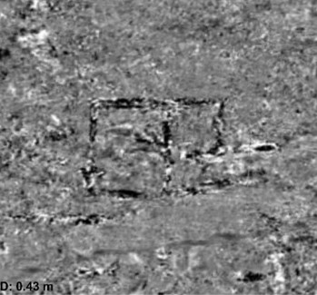
The ground conditions throughout the site were fairly good, enabling good penetration and clear images to be recorded. The client was very impressed with the results and said the following: “The Mira worked especially effectively in the area immediately adjacent to the existing site. It illuminated not only the details of Roman buildings here but we believe it also highlighted something of their changing histories…. One appears to have been partially demolished by the digging of what we think might be part of the later Roman defensive circuit.”
The project was undertaken for Newcastle University and they were so impressed with the data that they are hoping to gain funding to use the MIRA again on another similar project in Italy.