Netherton House,
West Netherton Street,
Kilmarnock, Ayrshire,
KA1 4BU
Case Study - Royal Botanical Gardens, Edinburgh

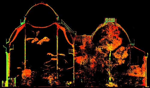
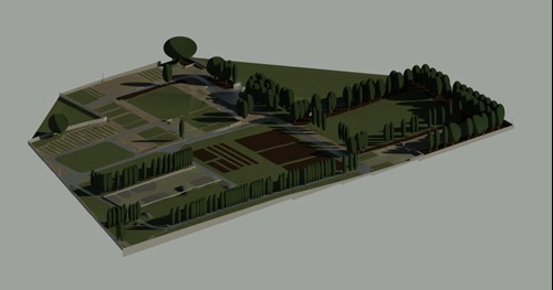
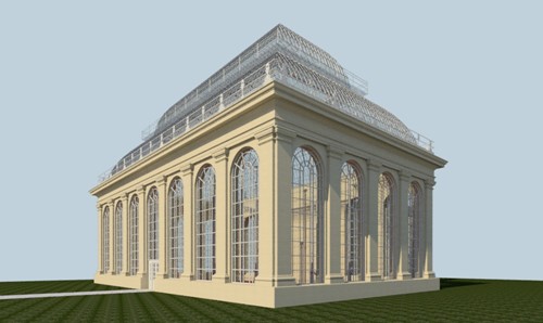
The Royal Botanic Garden Edinburgh required topographical and point cloud surveys in order to assist potential redevelopment of their site. There were two separate areas totaling approximately 85,000 m2.
Both the laser scanning and topographical work were completed during late September and early October. The topo was a particularly high-spec job with spot levels every 2 metres required along links and this part of the project was completed with little trouble. The requirements for the laser scanning were also high, with an early prediction of approximately 500 scans required. In the end 1068 scans were recorded, resulting in the largest data set that L&M have ever produced. The scan data was 1 terabyte but the client required the data in three different formats, totaling over 3TB of data. This pushed the limits of our software and hardware but was handled well by all the staff involved and we ended the project with a very impressive data set. The final piece of the jigsaw was the requirement of the topo data to be brought into Autodesk Revit. Normally, Revit is used purely for buildings, but this project was different and the topo data was imported and modeled into a complete 3d model. This data was delivered to the client using the BIM360 platform, a cloud-based sharing system owned by Autodesk.

This project was another that combined traditional survey methods with new ones and posed several challenges to the staff involved. A huge thanks to the staff involved on managing to overcome those challenges and successfully piece together all the data and deliver to the client’s satisfaction.